

Recommended Software
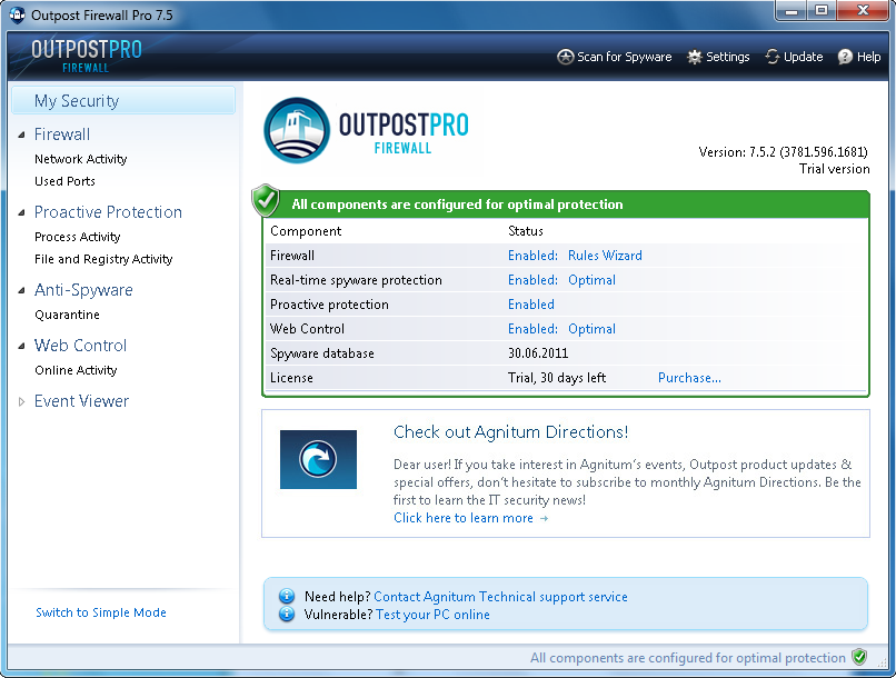
Agnitum Outpost Firewall Pro 7.5.1
PC defense against hackers, malware, viruses and Internet attacks. Inbound and outbound system and application firewall delivers powerful protection against a wide range of threats from local networks and the Internet and prevents unauthorized access to your PC. Protection for your OS and...
DOWNLOADSoftware Catalog
 Android Android |
Business & Productivity Tools |
| Desktop |
Developer Tools |
| Drivers |
Education |
| Games |
Home & Personal |
| Internet & Networking |
Multimedia & Design |
| Operating Systems |
Utilities |


C. Killet Software Ing.-GbR Info
Company: C. Killet Software Ing.-GbR
Country: Germany
State: NRW
City: Kempen
Zip code: 47896
Address:
Postbox 400225
Contacts
Phone: +49 (0)2152 961127
Fax: +49 (0)2152 961127
Site:
Email:
Author's Software
 TOPOWIN - TOPOWIN is a state-wide register of the German topographic cartographies and of localities with geo references in different coordinate systems. It also is a topographic information system.
 Geodaten German Admin (Deutsch) - Geodata of the Federal Republic Germany with municipalities, postal codes, telephone preselections. Georeferences as Gauss Krueger- UTM- and geographic coordinates. Suitable for branch searches, periphery searches and distance computations.
 ORTWIN - ORTWIN is a program for the inquiry of localities in Germany. It finds postal zip codes, telephone pre selections, coordinates. It performs perimeter searches and distance calculations. It finds landscapes, natural units, snow- and wind load zones.
 SEVENPAR (English) - SEVENPAR calculaties exact parameter sets for the Spatial Helmert or Molodensky Transformation with seven or three parameters, which are used for accurate geodetic datum shifts between different reference systems for coordinate transformations.
 TRANSDAT (English) - TRANSDAT Geosoftware executes coordinate transformations and geodetic datum shifts between lots of coordinate and reference systems of America, Australasia, Europe, Germany spec. and world-wide. The NTv2 standard with national grid files is supported
 TRANSDAT (Deutsch) - TRANSDAT Coordinate Conversion supports thousands of coordinate systems and geodetic datum shifts, user-defined systems, INSPIRE, NTv2, BeTA2007, GPS, continental drift, many file systems, ESRI-Shape and much more with highest accuracy.
 GEODLL32 (Deutsch) - In the DLL GeoDLL geodesic functions like 2D and 3D coordinate transformation, datum changes, meridian strip changes, NTv2, distance calculation, map functions, Digital Elevation Models ec. are contained to bind them into own WINDOWS applications.
 Top Downloads
- Jessica Alba Screensaver
- Jennifer Lopez
- Forum Proxy Leecher
- 365 US Navy Ships Screen Saver
- TATEMS Fleet Maintenance Software
- Intellexer Summarizer
- Internet Download Manager
- Abstract-Pictures Screensaver
- Forum Poster V2
- #1 Anonymous Proxy List Verifier

New Downloads
- Webcam Video Capture
- Piano Tiles
- PayWindow Payroll System
- Formats Customizer
- UnHackMe
- Four Points
- SurfOffline
- SignPack
- Zimbra Desktop to Outlook
- Web Log Explorer

New Reviews
- jZip Review
- License4J Review
- USB Secure Review
- iTestBot Review
- AbsoluteTelnet Telnet / SSH Client Review
- conaito VoIP SDK ActiveX Review
- conaito PPT2SWF SDK Review
- FastPictureViewer Review
- Ashkon MP3 Tag Editor Review
- Video Mobile Converter Review
Actual Software
| Link To Us
| Links
| Contact
Must Have
| TOP 100
| Authors
| Reviews
| RSS
| Submit


