

Recommended Software
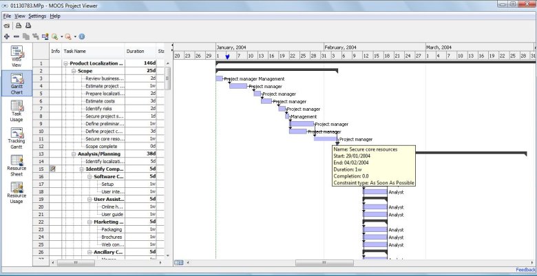
MS Project Viewer 2.8
MOOS Project Viewer is a Microsoft Project viewer that can open any MS Project file type (.mpp, .mpt, .mpx, .xml) for any Microsoft Project version (2000, 2003, 2007, 2010). Available views: WBS, Gantt chart, task sheet, resource sheet, resource usage, tracking Gantt. It is running on any Java...
DOWNLOADSoftware Catalog
 Android Android |
Business & Productivity Tools |
| Desktop |
Developer Tools |
| Drivers |
Education |
| Games |
Home & Personal |
| Internet & Networking |
Multimedia & Design |
| Operating Systems |
Utilities |


All | Free Mapping Distances Related Software Downloads
US Mileage Charts 2
DOWNLOAD
Cost: $20.00 USD
License: Freeware
Size: 1.2 MB
Download Counter: 10
VistaMetrix 1.33

DOWNLOAD
GET FULL VER
Cost: $49.95 USD
License: Shareware
Size: 5.3 MB
Download Counter: 19
ZoomMagic 2.03

DOWNLOAD
Cost: $39.99 USD
License: Freeware
Size: 1.6 MB
Download Counter: 18
sureshotgps golf gps 2.1
DOWNLOAD
GET FULL VER
Cost: $399.00 USD, 585.00 AUD
License: Shareware
Size: 3.8 MB
Download Counter: 182
MileCharter 2.12
DOWNLOAD
GET FULL VER
Cost: $60.00 USD, 100.00 USD
License: Shareware
Size: 3.7 MB
Download Counter: 14
Process Developer Enterprise Edition 2.1
DOWNLOAD
Cost: $0.00 USD
License: Demo
Size: 697.3 KB
Download Counter: 191
Pos HTML Image Mapper 1.00
DOWNLOAD
GET FULL VER
Cost: $24.90 USD
License: Shareware
Size: 6.8 MB
Download Counter: 10
Universal Desktop Ruler 2.5
DOWNLOAD
GET FULL VER
Cost: $19.95 USD
License: Shareware
Size: 901.5 KB
Download Counter: 82
Atelier Web Ports Traffic Analyzer 2.34
DOWNLOAD
GET FULL VER
Cost: $35.50 USD, 75.00 USD
License: Shareware
Size: 4.1 MB
Download Counter: 6
TierDeveloper 5.2.4
DOWNLOAD
GET FULL VER
Cost: $1495.00 USD
License: Commercial
Size: 17.4 MB
Download Counter: 7
Canvas GIS Mapping Edition 9.0.4
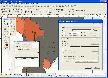
DOWNLOAD
GET FULL VER
Cost: $549.99 USD, 549.99 EUR
License: Shareware
Size: 54.2 MB
Download Counter: 15
Canvas GIS Mapping Edition (Mac) 9.0.4

DOWNLOAD
GET FULL VER
Cost: $549.99 USD, 549.99 EUR
License: Shareware
Size: 51.9 MB
Download Counter: 6
Calc 3D Pro 2.1.5
DOWNLOAD
Cost: $0.00 USD
License: Freeware
Size: 4.1 MB
Download Counter: 26
ChemDB 1.5
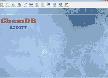
DOWNLOAD
GET FULL VER
Cost: $29.00 USD
License: Shareware
Size: 12.9 MB
Download Counter: 2
MarshallSoft GPS Component for eVC 1.2
DOWNLOAD
GET FULL VER
Cost: $105.00 USD
License: Shareware
Size: 256.7 KB
Download Counter: 8
Eye4Gps 2.1

DOWNLOAD
GET FULL VER
Cost: $149.00 USD, 99.00 EUR
License: Shareware
Size: 19.0 MB
Download Counter: 6
iFlyDisk 1.8
DOWNLOAD
GET FULL VER
Cost: $199.95 USD
License: Shareware
Size: 2.0 MB
Download Counter: 6
Mind Pad 3.1
DOWNLOAD
GET FULL VER
Cost: $60.00 USD
License: Shareware
Size: 3.2 MB
Download Counter: 7
TiVec 1.2
DOWNLOAD
GET FULL VER
Cost: $119.00 USD
License: Shareware
Size: 1.1 MB
Download Counter: 11
AGIS for Windows 2002
DOWNLOAD
GET FULL VER
Cost: $49.00 USD
License: Shareware
Size: 3.6 MB
Download Counter: 8
 Top Downloads
- Jessica Alba Screensaver
- Jennifer Lopez
- Forum Proxy Leecher
- 365 US Navy Ships Screen Saver
- TATEMS Fleet Maintenance Software
- Intellexer Summarizer
- Internet Download Manager
- Abstract-Pictures Screensaver
- Forum Poster V2
- #1 Anonymous Proxy List Verifier

New Downloads
- Webcam Video Capture
- Piano Tiles
- PayWindow Payroll System
- Formats Customizer
- UnHackMe
- Four Points
- SurfOffline
- SignPack
- Zimbra Desktop to Outlook
- Web Log Explorer

New Reviews
- jZip Review
- License4J Review
- USB Secure Review
- iTestBot Review
- AbsoluteTelnet Telnet / SSH Client Review
- conaito VoIP SDK ActiveX Review
- conaito PPT2SWF SDK Review
- FastPictureViewer Review
- Ashkon MP3 Tag Editor Review
- Video Mobile Converter Review
Actual Software
| Link To Us
| Links
| Contact
Must Have
| TOP 100
| Authors
| Reviews
| RSS
| Submit


