

Recommended Software
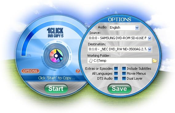
1Click DVD Copy 5.0.2.1
1CLICK DVD COPY™ 5 is fast and easy-to-use software for copying DVD movies. This latest version now utilizes CPRx™ error correction technology to ensure the highest level of success copying the latest generation of DVD movies.Now you can make a perfect copy of a DVD movie with just...
DOWNLOADSoftware Catalog
 Android Android |
Business & Productivity Tools |
| Desktop |
Developer Tools |
| Drivers |
Education |
| Games |
Home & Personal |
| Internet & Networking |
Multimedia & Design |
| Operating Systems |
Utilities |


Canvas GIS Mapping Edition (Mac)
Canvas GIS Mapping Edition (Mac) 9.0.4
Category:
Multimedia & Design / Graphic Viewers
| Author: ACD Systems
DOWNLOAD
Cost: $549.99 USD, 549.99 EUR
License: Shareware
Size: 51.9 MB
Download Counter: 6
2,104 Coordinate Reference Systems
67 Operation Methods (like Mercator, Albers Conic Equal Area??¦)
1,052 Map Projections
302 Geodetic Datums
21 Angular units
45 Length units
The CANVAS 9 GIS Mapping Edition bridges the gap between dedicated GIS analysis software and generic "DTP" software. For many applications CANVAS 9 GIS Mapping Edition can now replace programs costing thousands. For the rest, CANVAS 9 GIS Mapping Edition is now the preferred "last mile" publishing companion to dedicated GIS analysis software.
Requirements: PowerPC, Mac OS X, 128 MB RAM 100 MB HD, 16-bit graphics, 1024 x 768 res
OS Support: Unknown
Language Support:
Related Software
3d Graphics Software | Desktop Publishing | Desktop Software | Drawing Software | Engineering Software | Geotiff | Gis Positioning Software | Gis Software | Graphics Software | Hide Files Software | Presentation Software | Publication Software | Shape Files | Software dau-9p | Technical Drawing Software | Vector Illustration Software | Vector software | Web Graphics Software | Web Publishing Software
 Canvas GIS Mapping Edition - CANVAS 9 GIS Mapping Edition includes direct support for Geographic Information System data. You can take measurements in geographic coordinates, import SHAPE & GeoTIFF files into unlimited numbers of automatically aligned overlapping layers.
- Canvas Professional Edition - CANVAS 9 is the high-performance drawing environment for professionals in business, science, and engineering. It seamlessly integrates technical drawing, image editing, page layout, web graphics & presentation features into a single application.
- Canvas Professional Edition (Mac) - CANVAS 9 is the high-performance drawing environment for professionals in business, science, and engineering. It seamlessly integrates technical drawing, image editing, page layout, web graphics & presentation features into a single application.
- Canvas GIS Advanced (Mac) - CANVAS 9 Advanced GIS Mapping Edition: Direct support for Geographic Information System data. You can take measurements in geographic coordinates, import any popular GIS file types into unlimited numbers of automatically aligned overlapping layers.
- Canvas GIS Advanced - CANVAS 9 Advanced GIS Mapping Edition includes direct support for Geographic Information System data. Take measurements in geographic coordinates, import any popular GIS file types into unlimited numbers of automatically aligned overlapping layers.
- Canvas Scientific Imaging Edition (Mac) - CANVAS 9 Scientific Imaging Edition blends native support for advanced imaging and DICOM support with Canvas' full range of vector illustration, image editing, page layout, web graphics, and desktop presentation features.
- Canvas Scientific Imaging Edition - CANVAS 9 Scientific Imaging Edition blends native support for advanced imaging and DICOM support with Canvas' full range of vector illustration, image editing, page layout, web graphics, and desktop presentation features.
 VGEdit - VGEdit is an automated vector graphics editor with powerful Raster To Vector, DXF and SVG Converters and the best choice for creating business and technology graphics.
 Sketsa - Sketsa is a cross platform vector drawing application based on SVG. Sketsa features various tools for optimizing content creation, giving designers unsurpassed support for creativity.
 CeledyDraw 2 - CeledyDraw 2 is a 2-in-1 Graphic Design and Desktop Publishing program that's ideal for use in homes, schools, and small-businesses.
CeledyDraw 2 is powerful, easy-to-use, and affordable.
CeledyDraw 2 - CeledyDraw 2 is a 2-in-1 Graphic Design and Desktop Publishing program that's ideal for use in homes, schools, and small-businesses.
CeledyDraw 2 is powerful, easy-to-use, and affordable.
 Top Downloads
- STP Viewer
- Inzomia viewer
- VMCPlayer
- Free DWG Viewer
- 3D Shell Extensions
- Neon Animated Cursors
- Thumbs.db Viewer
- Banner Maker Pro
- ACDSee Plugin - DeskTop Author
- Animated Inverse Cursor Scheme

New Downloads
- Expos
- AViCAD
- FURNIT
- RTOPO
- VMCPlayer
- AhaView
- Image Viewer Indepth
- VidShot Capturer
- SageThumbs
- FritzTv

New Reviews
- jZip Review
- License4J Review
- USB Secure Review
- iTestBot Review
- AbsoluteTelnet Telnet / SSH Client Review
- conaito VoIP SDK ActiveX Review
- conaito PPT2SWF SDK Review
- FastPictureViewer Review
- Ashkon MP3 Tag Editor Review
- Video Mobile Converter Review
Actual Software
| Link To Us
| Links
| Contact
Must Have
| TOP 100
| Authors
| Reviews
| RSS
| Submit


