Recommended Software
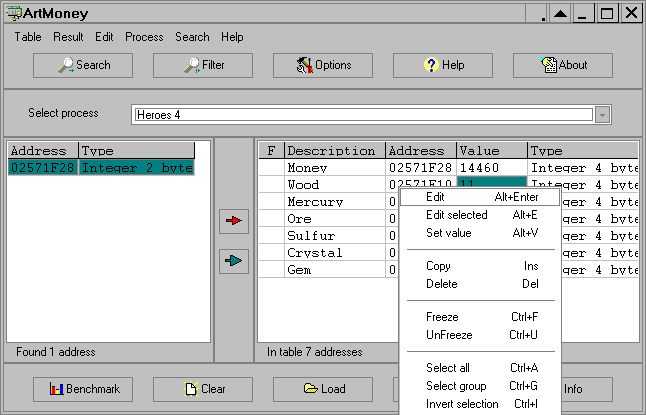
ArtMoney 7.39.2
ArtMoney is a cheating program you can use for all games. ArtMoney can make a troublesome game easier to win by helping you find the memory address where a desired quantity (like amount of money) is located so you can change that quantity. In spite of its title, ArtMoney actually allows you to...
DOWNLOADSoftware Catalog
 Android Android |
 Business & Productivity Tools Business & Productivity Tools |
 Desktop Desktop |
 Developer Tools Developer Tools |
 Drivers Drivers |
 Education Education |
 Games Games |
 Home & Personal Home & Personal |
 Internet & Networking Internet & Networking |
 Multimedia & Design Multimedia & Design |
 Operating Systems Operating Systems |
 Utilities Utilities |


Eye4Gps Download
Eye4Gps 2.1
GPS Mapping Software for Windows, Loading topographic maps, manage GPS devices and more. The software can be used with various map formats including: GeoTiff, BSB Nautical Charts, AutoCad DXF files, ESRI Shapefiles. Using calibration you can also use scanned or downloaded JPG, BMP, GIF, PNG and TIF maps. The software can be used for survey, research, track and trace, real time positioning and navigation.
Size: 19.0 MB | Download Counter: 6
If Eye4Gps download does not start please click this:
Can't download? Please inform us.
Related Software
 Mapyx Quo - Mapyx Quo enables you to connect your GPS to your PC. View information - elevation, distance, speed, ETA,etc... Quo supports: GE KML,GPX format,ESRI SHP,Geocaching,Garmin,Magellan,OziExplorer files and more. Includes importing your own scanned maps.
 OkMap - OkMap is a software that works with vectorial and raster maps that you have bought or scanned. OkMap lets you organize paths by creating waypoints, routes and tracks, and upload/download data to/from your GPS. OkMap supports GPS real-time navigation.
 RouteWriter - Imports and Exports MapPoint waypoints and pushpins in route-order. MapPoint always re-arranges pushpins when it does this. Exports routes directly to Excel, or you can create a route from pushpins in a pre-determined order.
 FishInSight - Fishing Log software for windows. Use FishInSight to record your catches, including details such as Sun/Moon and Tide information, Solunar tables, location (GPS and mapping support) and equipment used.
 Garmin Phase Output Plug-In for GPS.NET - The Garmin Phase Output protocol gives software developers the ability to upload and download data from Garmin devices. The Garmin Phase Output plug-in for GPS.NET makes working with Garmin devices easy!
 GIS.NET - Develop high-performance mapping with GIS.NET. This component uses state-of-the-art vector rendering technology to draw complicated maps of anywhere in the world. Supports desktops, PocketPC, Tablet PC, Smartphone, and Windows Mobile!
 RoboGEO - Geocode photos from a GPS for GIS field data collection. Stamp the images or write to the EXIF headers. Export Google Maps, KML KMZ files for Google Earth, Shapefiles (SHP), AutoCAD DXF files, or Flickr. Import from tracklogs, waypoints or GPX.
 Canvas GIS Mapping Edition - CANVAS 9 GIS Mapping Edition includes direct support for Geographic Information System data. You can take measurements in geographic coordinates, import SHAPE & GeoTIFF files into unlimited numbers of automatically aligned overlapping layers.
 Canvas GIS Mapping Edition (Mac) - CANVAS 9 GIS Mapping Edition includes direct support for Geographic Information System data. You can take measurements in geographic coordinates, import SHAPE & GeoTIFF files into unlimited numbers of automatically aligned overlapping layers.
 Process Developer Enterprise Edition - Activity Mapping, flowchart mapping & document control can all be achieved via this simple tool.It helps the organization to meet the ISO 9000:2000 process mapping requirements, requires no training & can be used by anyone with Excel '97 or Later.

 Top Downloads
- SurGe
- Easy Measure Converter
- GSA Image Analyser
- Audio Spectrum Analyzer - OscilloMeter
- Audio Multi-Tone Generator
- Rimu PCB
- Satellite Image Browser
- Flow Pro
- GENOM 2005
- Advanced Pathway Painter

 New Downloads
- LateralK
- GSA Image Analyser
- RadioTelephone Tutor
- BSAcalc
- PL Table
- LeoNetCDF
- LeoCrystal
- Advanced Pathway Painter
- GENOM 2005
- Quakeshakes

New Reviews
- jZip Review
- License4J Review
- USB Secure Review
- iTestBot Review
- AbsoluteTelnet Telnet / SSH Client Review
- conaito VoIP SDK ActiveX Review
- conaito PPT2SWF SDK Review
- FastPictureViewer Review
- Ashkon MP3 Tag Editor Review
- Video Mobile Converter Review
Actual Software
| Link To Us
| Links
| Contact
Must Have
| TOP 100
| Authors
| Reviews
| RSS
| Submit
