

Recommended Software
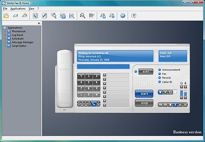
VentaFax Business 6.0
VentaFax is a full-featured fax and answering machine software with color fax support. It sends and receives faxes and turns your PC with a fax modem into a versatile answering machine with remote control and email integration. You can retrieve your fax and voice messages from any touchtone phone...
DOWNLOADSoftware Catalog
 Android Android |
Business & Productivity Tools |
| Desktop |
Developer Tools |
| Drivers |
Education |
| Games |
Home & Personal |
| Internet & Networking |
Multimedia & Design |
| Operating Systems |
Utilities |


GEODLL32 (Deutsch) Feedback System
GEODLL32 (Deutsch) Info

License: Shareware | Author: C. Killet Software Ing.-GbR | Requirements: 200 MHz, 256 MB Memory, 10 MB HD
GeoDLL supports the development of geodetic software on various platforms by providing geodetic functions. GeoDLL contains precise functions of the themes 2D and 3D coordinate transformation, geodetic datum shift and reference system convertion, meridian strip changing, user defined coordinate and reference systems, distance calculation, Digital Elevation Model, NTv2 handling and map function. GeoDLL enables to perform professional grade coordinate transformations in own programs: 1.The current and historical coordinate and reference systems of all countries of the European Union (EU) including the eastern extensions and the systems of non-EU countries. 2. The INSPIRE© supported European ETRS89 systems. 3. The US and Canadian State Plane Coordinate Systems (SPCS) on NAD27 and NAD83 and other coordinate systems of the North American continent. 4. The coordinate and reference systems of the Australasian continent. 5. Many coordinate and reference systems of the countries of other continents. 6. World-wide NTv2 grid file supported coordinate transformations. 7. All world-wide coordinate and reference systems in current use. 8. The German coordinate and reference systems of the old and new federal states, the 40 Prussian Soldner Land Registers, the German ‘Lagestatus’, and exact reference systems of the German federal states. User coordinate systems, local reference systems and earth ellipsoids can be defined, based on the coordinate system parameters, the semi axes of the earth and seven Helmert or three Molodenski datum parameters. GeoDLL comes with extensive documentation and is supplied as a DLL file or as C++ or CA-Visual Objects source code. The functions of GeoDLL are suitable for multithreading. The DLL is written in the C++ language. That gives very fast performance, compact code, and high stability in use.
Notice: * - required fields
C. Killet Software Ing.-GbR Software
 TOPOWIN - TOPOWIN is a state-wide register of the German topographic cartographies and of localities with geo references in different coordinate systems. It also is a topographic information system.
 Geodaten German Admin (Deutsch) - Geodata of the Federal Republic Germany with municipalities, postal codes, telephone preselections. Georeferences as Gauss Krueger- UTM- and geographic coordinates. Suitable for branch searches, periphery searches and distance computations.
 ORTWIN - ORTWIN is a program for the inquiry of localities in Germany. It finds postal zip codes, telephone pre selections, coordinates. It performs perimeter searches and distance calculations. It finds landscapes, natural units, snow- and wind load zones.
 SEVENPAR (English) - SEVENPAR calculaties exact parameter sets for the Spatial Helmert or Molodensky Transformation with seven or three parameters, which are used for accurate geodetic datum shifts between different reference systems for coordinate transformations.
 TRANSDAT (English) - TRANSDAT Geosoftware executes coordinate transformations and geodetic datum shifts between lots of coordinate and reference systems of America, Australasia, Europe, Germany spec. and world-wide. The NTv2 standard with national grid files is supported
 TRANSDAT (Deutsch) - TRANSDAT Coordinate Conversion supports thousands of coordinate systems and geodetic datum shifts, user-defined systems, INSPIRE, NTv2, BeTA2007, GPS, continental drift, many file systems, ESRI-Shape and much more with highest accuracy.
 Top Downloads
- Form Resizer (For Microsoft Access)
- Lansweeper
- DBDesigner 4
- Universal SQL Editor
- Query Tool (using ADO)
- CASE Studio 2
- Advanced Data Import
- SimpleLPR
- TOAD for SQL Server
- Debugger for MySQL

New Downloads
- Universal SQL Editor
- Net Monitor for Employees Professional
- Lansweeper
- TextPipe Pro
- Easy Query Builder
- DTM Schema Reporter
- dotNet Protector
- PHPMaker
- KlassBuilder
- Debugger for MySQL

New Reviews
- jZip Review
- License4J Review
- USB Secure Review
- iTestBot Review
- AbsoluteTelnet Telnet / SSH Client Review
- conaito VoIP SDK ActiveX Review
- conaito PPT2SWF SDK Review
- FastPictureViewer Review
- Ashkon MP3 Tag Editor Review
- Video Mobile Converter Review
Actual Software
| Link To Us
| Links
| Contact
Must Have
| TOP 100
| Authors
| Reviews
| RSS
| Submit


