Recommended Software

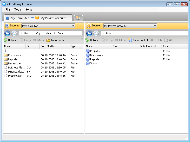
CloudBerry Explorer for Amazon S3 1.5.1.39
CLOUDBERRY EXPLORER FOR AMAZON S3 CloudBerry S3 Explorer makes managing files in Amazon S3 EASY. By providing an industry leading user interface (GUI) to Amazon S3 accounts, files, and buckets, CloudBerry lets you manage your files on cloud just as you would on your own local computer. New...
DOWNLOADSoftware Catalog
 Android Android |
 Business & Productivity Tools Business & Productivity Tools |
 Desktop Desktop |
 Developer Tools Developer Tools |
 Drivers Drivers |
 Education Education |
 Games Games |
 Home & Personal Home & Personal |
 Internet & Networking Internet & Networking |
 Multimedia & Design Multimedia & Design |
 Operating Systems Operating Systems |
 Utilities Utilities |


ESRI Shapefile Plug-In for GIS.NET Download
ESRI Shapefile Plug-In for GIS.NET 2.0
ESRI shapefiles are one of the most popular spatial data formats for describing features on Earth's surface. This plug-in adds support for ESRI shapefile data in GIS.NET. Quickly load, modify and save shapefile data, including vector information (.SHP) as well as annotations (.DBF). Shapes are loaded in a form which can be instantly displayed in a GIS.NET map on any desktop, PocketPC, Smartphone or Windows Mobile 5 device!
The ESRI Shapefile Plug-In for GIS.NET supports all of these features:
LIMITED TIME: This plug-in is included FREE with the GIS.NET 2.0 mapping component!
Full support for desktops, PocketPC, WindowsCE, Smartphone and Windows Mobile.
Automatically detects whether data is stored in UTM or latitude/longitude coordinates.
Automatically selects the best bulk transfer rate to load and save files as fast as possible.
Automatically loads annotations from ".DBF" files and links them with shapes from ".SHP" shapefiles.
Multithreaded design can load large shapefiles in the background.
Stream-based architecture allows loading of shapefiles from disk, networks, or any other .NET Stream!
Supports an unlimited number shapes, limited only by available memory.
Dynamic Help and IntelliSense for Visual Studio.NET
Windows Mobile™ certified
Unlimited, royalty-free redistribution!
Download a free 30-day trial now and see just how fast GIS.NET can get your application working with ESRI shapefiles!
Size: 5.4 MB | Download Counter: 14
If ESRI Shapefile Plug-In for GIS.NET download does not start please click this:
Download Link 1
Can't download? Please inform us.
Related Software
 GIS.NET - Develop high-performance mapping with GIS.NET. This component uses state-of-the-art vector rendering technology to draw complicated maps of anywhere in the world. Supports desktops, PocketPC, Tablet PC, Smartphone, and Windows Mobile!
 Mapyx Quo - Mapyx Quo enables you to connect your GPS to your PC. View information - elevation, distance, speed, ETA,etc... Quo supports: GE KML,GPX format,ESRI SHP,Geocaching,Garmin,Magellan,OziExplorer files and more. Includes importing your own scanned maps.
 MPSuperShape - MPSuperShape is a shape manipulation tool for Microsoft MapPoint. MPSuperShape can combine shapes, find overlaps, find boundaries, and import/export various files. MapPoint 2006, .NET Framework 2.0 (or later), and Windows XP or Vista required.
 Geometry Master - Geometry Master 3.0 is a Geometry Help software that enhances Geometrical, Spatial and Drawing skills using geometry drawing tools on the computer screen. The Geometry Worksheets & terms program comes with many excellent drawing tools.
 Canvas GIS Advanced (Mac) - CANVAS 9 Advanced GIS Mapping Edition: Direct support for Geographic Information System data. You can take measurements in geographic coordinates, import any popular GIS file types into unlimited numbers of automatically aligned overlapping layers.
 Canvas GIS Advanced - CANVAS 9 Advanced GIS Mapping Edition includes direct support for Geographic Information System data. Take measurements in geographic coordinates, import any popular GIS file types into unlimited numbers of automatically aligned overlapping layers.
 AvisMap Deskpro - AvisMap Desktop Professional 5 is a professional desktop GIS software for map editing, managing, analysis attribute data, aid decision-making transactions and output map, print tables, 3D modeling, and other functions.
 MSU Denoising VirtualDub Video plugin - Free high-quality video denoiser plugin for VirtualDub. Allows flexible denoising level setup in temporal and spatial dimensions. Easy to use. Filter is designed for noisy video stream processing, video quality improvement, or video preprocessing.
 3D Soma Puzzle - 3D Soma Puzzle is a logic game that challenges you to assemble various figures with the colored irregular 3D-blocks. At the first sight it seems to be simple but great variety of solutions for each shape make the game really challenging.
 Canvas GIS Mapping Edition (Mac) - CANVAS 9 GIS Mapping Edition includes direct support for Geographic Information System data. You can take measurements in geographic coordinates, import SHAPE & GeoTIFF files into unlimited numbers of automatically aligned overlapping layers.

 Top Downloads
- Intellexer Summarizer
- SMS Messaging SDK
- HS NMEA GPS C Source Library
- Mime4Net: Email and Mime parser for .Net
- Windows Std Serial Comm Lib for Visual Basic
- Polyglot 3000
- Alvas.Audio
- Super 2d/3d Graph Library
- PDF Maker
- ANPOP POP3 Component Build

 New Downloads
- Polyglot 3000
- PDF Security ActiveX
- .Net Grid
- PlotLab .NET
- VideoLab .NET
- HS TFTP C Source Library
- License4J
- LinqConnect
- TX Text Control ActiveX Standard
- TX Text Control ActiveX Professional

New Reviews
- jZip Review
- License4J Review
- USB Secure Review
- iTestBot Review
- AbsoluteTelnet Telnet / SSH Client Review
- conaito VoIP SDK ActiveX Review
- conaito PPT2SWF SDK Review
- FastPictureViewer Review
- Ashkon MP3 Tag Editor Review
- Video Mobile Converter Review
Actual Software
| Link To Us
| Links
| Contact
Must Have
| TOP 100
| Authors
| Reviews
| RSS
| Submit


