Recommended Software

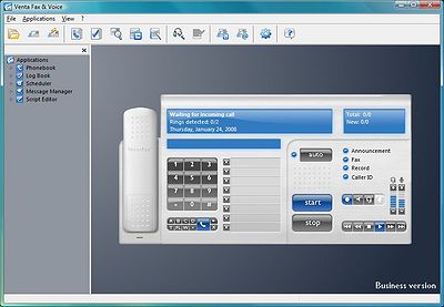
VentaFax Business 6.0
VentaFax is a full-featured fax and answering machine software with color fax support. It sends and receives faxes and turns your PC with a fax modem into a versatile answering machine with remote control and email integration. You can retrieve your fax and voice messages from any touchtone phone...
DOWNLOADSoftware Catalog
 Android Android |
 Business & Productivity Tools Business & Productivity Tools |
 Desktop Desktop |
 Developer Tools Developer Tools |
 Drivers Drivers |
 Education Education |
 Games Games |
 Home & Personal Home & Personal |
 Internet & Networking Internet & Networking |
 Multimedia & Design Multimedia & Design |
 Operating Systems Operating Systems |
 Utilities Utilities |


RoboGEO Download
RoboGEO 5.0
Geocode digital images with latitude, longitude, altitude, and direction information when collecting GIS field data. RoboGEO stamps this information onto the actual photo or writes it to the EXIF headers, allowing you to permanently geotag and link your photos to the GPS coordinates. All writing to the EXIF and IPTC headers is lossless and all of the existing comments (including the MakerNote and the Adobe XMP metadata) are preserved. Includes a Picasa style geotagger for Google Earth. Create web pages that use Google Maps, export KML or KMZ files to Google Earth, upload geotagged photos to Flickr, export ESRI SHP shapefiles, export to MapPoint, or export DXF files for use in various vector based drawing programs such as AutoCAD or IntelliCAD. Show the photo direction on maps and calculate it from the GPS tracklog. Automatically merge EXIF or IPTC tags into the image titles and descriptions. Record dictation using any modern digital voice recorder and automatically associate audio with the photos. Rotate or redate images based on the EXIF info. Export GPX files. Edit the EXIF times. Photo locations can be projected to a new location in either ground or airplane mode. Free EXIF/IPTC viewer included. Geocode any type of JPG, PNG, BMP, TIF, or Adobe DNG file. Directly supports Garmin GPS units (USB or COM), but no GPS is required. Georeference images from a GPS tracklog, NMEA sentences or waypoints. Import GPX files for interfacing with other GPS makes and models like Magellan, Lowrance or Trimble. Supports DNR Garmin. Includes an image renaming utility that renames images based on the EXIF data. Works with any modern digital camera. Internationally aware. Very easy to use. Nice user interface. Perfect tool for aerial photography, land surveyors, engineers, insurance claim adjusters or anyone who needs to collect field data for integration into a GIS system. Low cost. Free lifetime upgrades. Extensive on-line documentation.
Size: 6.4 MB | Download Counter: 14
If RoboGEO download does not start please click this:
|
Can't download? Please inform us.
Related Software
 HoudahGeo - One-stop photo geocoding for the Mac: Know Where you Took that Photo. Write geotags to EXIF, XMP & IPTC. See your photos in Google Earth. Share geocoded photos on Flickr and Locr.com
 OkMap - OkMap is a software that works with vectorial and raster maps that you have bought or scanned. OkMap lets you organize paths by creating waypoints, routes and tracks, and upload/download data to/from your GPS. OkMap supports GPS real-time navigation.
 MPSuperShape - MPSuperShape is a shape manipulation tool for Microsoft MapPoint. MPSuperShape can combine shapes, find overlaps, find boundaries, and import/export various files. MapPoint 2006, .NET Framework 2.0 (or later), and Windows XP or Vista required.
 Mapyx Quo - Mapyx Quo enables you to connect your GPS to your PC. View information - elevation, distance, speed, ETA,etc... Quo supports: GE KML,GPX format,ESRI SHP,Geocaching,Garmin,Magellan,OziExplorer files and more. Includes importing your own scanned maps.
 Google Maps Downloader - Google Maps Downloader is a cute tool that can automatically download Google Maps' small tile map images and then combine them into one big map image.It supports multithreads, so the download speed is very fast. And it is very easy to use.
 GridImp - Imports gridded data into MS-MapPoint, to produce attractive data maps.
Input data is defined with geographic coordinates, allowing plots such as seismic hazard, customer/population distribution, etc. Various text formats and coordinates supported.
 RouteWriter - Imports and Exports MapPoint waypoints and pushpins in route-order. MapPoint always re-arranges pushpins when it does this. Exports routes directly to Excel, or you can create a route from pushpins in a pre-determined order.
 ESRI Shapefile Plug-In for GIS.NET - ESRI shapefiles are one of the most popular spatial data formats for describing features on Earth's surface. This plug-in adds support for ESRI shapefile data in GIS.NET. Quickly load and create shapes (.SHP) as well a annotation (.DBF) files!
 ZylGPSSimulator - ZylGPSSimulator is a Delphi GPS receiver simulator component. It creates a virtual serial port, converts the position parameters in NMEA format and writes them to the virtual port. The user can set parameters like latitude, longitude, altitude...
 Image Properties for Camera Phones - This is a utility designed to read EXIF information of JPEG images captured by camera phones.

 Top Downloads
- T3D - 2D to 3D Converter
- Easy Photo Frame
- Life Photo Maker
- PhotoInstrument
- RasterVect
- ASCII Art Generator
- Amazing Photo Editor
- Algolab Raster to Vector Conversion Toolkit
- MakeUp Instrument
- IE Picture Framer

 New Downloads
- reaConverter Pro
- RasterVect
- Easy Photo Frame
- PhotoInstrument
- MakeUp Instrument
- TiffSplitter
- HardCopy Pro
- IncrediFace
- Pixel Editor
- Photopus

New Reviews
- jZip Review
- License4J Review
- USB Secure Review
- iTestBot Review
- AbsoluteTelnet Telnet / SSH Client Review
- conaito VoIP SDK ActiveX Review
- conaito PPT2SWF SDK Review
- FastPictureViewer Review
- Ashkon MP3 Tag Editor Review
- Video Mobile Converter Review
Actual Software
| Link To Us
| Links
| Contact
Must Have
| TOP 100
| Authors
| Reviews
| RSS
| Submit


