

Recommended Software
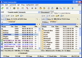
Total Commander 7.01
Total Commander (former Wincmd) is an Explorer replacement for Windows. This is the 32 bit version for Windows 9x, ME, NT, 2000, and XP. A 16 bit version is also available as tc16v656.zip. Total Commander handles archives like subdirectories. It supports...
DOWNLOADSoftware Catalog
 Android Android |
Business & Productivity Tools |
| Desktop |
Developer Tools |
| Drivers |
Education |
| Games |
Home & Personal |
| Internet & Networking |
Multimedia & Design |
| Operating Systems |
Utilities |


MPMileage Download
MPMileage 2.1
Batch calculate route distances, travel times, and/or estimated costs for point-to-point routes listed in a database (Access, Excel, or ODBC). Uses Microsoft MapPoint for point locations and route calculations. Supports all of MapPoint's route options including fastest routes, shortest routes, preferred roads, and straight lines (Great Circles). Start and end locations are specified using pushpins, longitude/latitude coordinates, or street addresses. Road speeds/etc can also be set. Supports all versions of MapPoint from MapPoint 2006 to the latest MapPoint 2011. The database can be any version of Access or Excel v2003 onwards. Access or an ODBC database is recommended for speed. ODBC support includes runtime login credentials, and all three kinds of Data Source Names (DSNs): User DSNs, System DSNs, and File DSNs. Supports Windows XP, Windows Vista, and Windows 7. Also supports multi-core machines: Run on a quad core (or better) for huge speeds up over conventional MapPoint batch calculation tools.
Single licenses cost US$75 and there is a free 14 day trial.
Size: 3.1 MB | Download Counter: 7
If MPMileage download does not start please click this:
Download Link 1 | Download Link 2
Can't download? Please inform us.
Related Software
 MileCharter - Calculate Mileage Charts and Tables with Microsoft MapPoint. Calc. tables for customers and suppliers incl. "closest only", or to create "road atlas" tables. Output Distances, travel times and/or estimated costs to Excel. Supports ALL route options.
 RouteWriter - Imports and Exports MapPoint waypoints and pushpins in route-order. MapPoint always re-arranges pushpins when it does this. Exports routes directly to Excel, or you can create a route from pushpins in a pre-determined order.
 US Mileage Charts - US Mileage Charts and Tables in Excel format, including travel times and distances for both the fastest and shortest routes.
Includes sets of tables for every US State, and one large pan-US chart.
US Mileage Charts - US Mileage Charts and Tables in Excel format, including travel times and distances for both the fastest and shortest routes.
Includes sets of tables for every US State, and one large pan-US chart. ZIP Code Distance Wizard - Locates ZIP Codes that are within close proximity of a specified ZIP Code. All you do is type in a ZIP Code, specify the radius distance in miles, and within seconds, a list of ZIP Codes that fall within that radius is displayed.
 XCBA Route Planner - Production of a passage plan prior to departure is a legal requirement. Route Planner assists in the preparation of passage plans by allowing you to prepare, calculate and print full featured passage plan.
 NetCatcher - Anseko NetCatcher easily allows to perfom automatically necessary actions when the status of network interfaces is changing.
 Route Manager - Route Manager is a complete application that allows vending operators to easily manage and track every aspect of a vending operation. Track new and potential leads that become customers.
 Gas Mileage MPG Tracker - Software to assist drivers in tracking their gas mileage usage. Can be used to track MPG on multiple cars or other vehicles. You can track your miles per gallon in the city and on the highway. See your average MPG for each tank of gas and over time.
 Mapyx Quo - Mapyx Quo enables you to connect your GPS to your PC. View information - elevation, distance, speed, ETA,etc... Quo supports: GE KML,GPX format,ESRI SHP,Geocaching,Garmin,Magellan,OziExplorer files and more. Includes importing your own scanned maps.
 Universal Desktop Ruler - It allows you to measure not only a straight line distance but any curved distance on the Screen. It allows you to measure quickly and accurately distances, areas and perimeters of figures on the screen.
 Top Downloads
- Rotating Shift Schedules for Your People
- Customer Invoice Template
- SQL Excel
- RoofCOST Estimator for Excel
- Excel File Size Reduce Software
- United States 5-Digit ZIP Code Database, Gold Edition
- Excel Compare
- Excel VBA Models Combo Set
- DoneEx XCell Compiler
- ExcelPipe Search and Replace

New Downloads
- TrailBlazer
- Scanitto Pro
- MPMileage
- Total Excel Converter
- DoneEx XCell Compiler
- Simple Notes Organizer
- Advanced ID Creator Personal
- Form Pilot Pro
- Excel Compare
- CHM2Word

New Reviews
- jZip Review
- License4J Review
- USB Secure Review
- iTestBot Review
- AbsoluteTelnet Telnet / SSH Client Review
- conaito VoIP SDK ActiveX Review
- conaito PPT2SWF SDK Review
- FastPictureViewer Review
- Ashkon MP3 Tag Editor Review
- Video Mobile Converter Review
Actual Software
| Link To Us
| Links
| Contact
Must Have
| TOP 100
| Authors
| Reviews
| RSS
| Submit


